


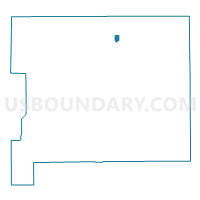
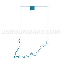
CLAY TWP 01, St. Joseph County, Indiana
About
Outline

Summary
| Unique Area Identifier | 580369 |
| Name | CLAY TWP 01 |
| County | St. Joseph County |
| State | Indiana |
| Area (square miles) | 0.38 |
| Land Area (square miles) | 0.38 |
| Water Area (square miles) | 0.00 |
| % of Land Area | 100.00 |
| % of Water Area | 0.00 |
| Latitude of the Internal Point | 41.71771880 |
| Longtitude of the Internal Point | -86.25055930 |
Maps

Graphs
Select a template below for downloading or customizing gragh for CLAY TWP 01, St. Joseph County, Indiana


Neighbors
Neighoring Voting District (by Name) Neighboring Voting District on the Map
- CLAY TWP 04, St. Joseph County, IN
- CLAY TWP 05, St. Joseph County, IN
- CLAY TWP 24, St. Joseph County, IN